The determined boundaries procedure allows the exact line of a boundary to be determined and recorded on a register of title.
An application for a determined boundary is made to the Land Registry using form DB.
Ideally an application for a determined boundary should be made with the agreement of both parties.
An alternative way of clarifying a boundary is for the adjoining owners to enter into a formal boundary agreement and applying for it to be noted on the individual registers.
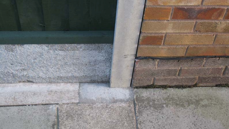
The plan that accompanies the application for a determined boundary is known as a Determined Boundary Plan.
Determined Boundary Plan
Survey Three Limited has many years of experience of producing Determined Boundary Plans.
Determined Boundary Plans show the boundary in great detail including the start and end of the boundary and individual fence posts. Dimension from fixed points such as building corners will be shown to enable the boundary to be re-established in the future. If no suitable fixed points are available, National Grid coordinates will be used instead of dimensions.
Determined Boundary Plan Requirements
The Land Registry practice guide 40 "HM Land Registry plans, supplement 4, boundary agreements and detrmined boundaries", sets out the requirements for determined boundary plans are as follows:
An application for a determined boundary is made to the Land Registry using form DB.
Ideally an application for a determined boundary should be made with the agreement of both parties.
An alternative way of clarifying a boundary is for the adjoining owners to enter into a formal boundary agreement and applying for it to be noted on the individual registers.
The plan that accompanies the application for a determined boundary is known as a Determined Boundary Plan.
Determined Boundary Plan
Survey Three Limited has many years of experience of producing Determined Boundary Plans.
Determined Boundary Plans show the boundary in great detail including the start and end of the boundary and individual fence posts. Dimension from fixed points such as building corners will be shown to enable the boundary to be re-established in the future. If no suitable fixed points are available, National Grid coordinates will be used instead of dimensions.
Determined Boundary Plan Requirements
The Land Registry practice guide 40 "HM Land Registry plans, supplement 4, boundary agreements and detrmined boundaries", sets out the requirements for determined boundary plans are as follows:
Survey Three Limited
•
The extents of the determined boundary must be clearly shown by suitable colouring/edging.
•
The plan must identify the start, end and any points turning points of the determined boundary, preferably by way of lettered points.
•
The plan must include a statement describing the determined boundary. For example, "The exact line of the boundary to be determined is between the points A-B-C-D and runs along the centre line of the dividing wall".
•
Sufficient surrounding detail must be shown to allow the general position of the boundary to be identified on the Ordnance Survey map.
•
The plan must be drawn to a stated scale. Ideally no smaller than 1:200.
•
The plan must be no larger than A3 size.
•
A north point and scale bar must be included.
•
The plan must describe the relationship with physical features where the boundary coincides with them - for example, on which side of the physical feature the boundary runs, or through which point of the physical features the boundary passes.
•
The plan must describe points of reference, and from where on that reference point measurements have be taken, for example, "north east corner of building", "south west corner of post", in the plan legend. If a measurement is taken from a reference point which is not part of a physical feature on the ground, this point must be marked by a permanent ground marker.
•
The plan must only include information and detail that is relevant - any superfluous information.that could clutter the plan or possibly contradict the relevant information should be left off, and any co-ordinates shown on the plan that are not National Grid co-ordinates must be removed.
•
The plan must not contain any statement of disclaimers or endorsements which casts doubt on the accuracy of the plan such as "for identification purposes only".
•
All relevant parties must sign the plan.
Requirements for a Determined Boundary Plan where measurements are used
In addition to the above requirements, Land Registry practice guide 40 states that any measurements shown on the plan must:
In addition to the above requirements, Land Registry practice guide 40 states that any measurements shown on the plan must:
•
be accurate to +/- 10mm.
•
be taken horizontally.
•
be taken from at least 2 defined points on surrounding permanent physical features such as the corners of buildings, and preferably from both sides of the boundary.
Note: Permanent physical features are taken to be those which it is reasonable to assume will remain in position for at least 10 years
The determined boundary plan must be endorsed with a certificate as to its accuracy as follows:
"I certify that the measurements shown on this plan are accurate to +/-10mm"
Requirements for a Determined Boundary Plan where co-ordinates are used
Land Registry practice guide 40 sets out the following additional requirements for where the determined boundary plan is based on co-ordinates, or where co-ordinates are used as associated points of reference for measurements:
•
The only co-ordinates that will be accepted are National Grid co-ordinates.
•
The National Grid co-ordinates must have an absolute accuracy of +/- 300mm and a relative accuracy of +/- 10mm.
•
The co-ordinates should be recorded as a set of two eight digit numbers with the eastings first.
The determined boundary plan must be endorsed with a certificate as to its accuracy as follows:
"I certify that the National Grid co-ordinates shown on this plan have an absolute accuracy of +/-300mm and a relative accuracy of +/-10mm"
Please contact us for a quotation or further information
"I certify that the National Grid co-ordinates shown on this plan have an absolute accuracy of +/-300mm and a relative accuracy of +/-10mm"
Please contact us for a quotation or further information
Determined Boundaries
•
The extents of the determined boundary must be clearly shown by suitable colouring/edging.
•
The plan must identify the start, end and any points turning points of the determined boundary, preferably by way of lettered points.
•
The plan must include a statement describing the determined boundary. For example, "The exact line of the boundary to be determined is between the points A-B-C-D and runs along the centre line of the dividing wall".
•
Sufficient surrounding detail must be shown to allow the general position of the boundary to be identified on the Ordnance Survey map.
•
The plan must be drawn to a stated scale. Ideally no smaller than 1:200.
•
The plan must be no larger than A3 size.
•
A north point and scale bar must be included.
•
The plan must describe the relationship with physical features where the boundary coincides with them - for example, on which side of the physical feature the boundary runs, or through which point of the physical features the boundary passes.
•
The plan must describe points of reference, and from where on that reference point measurements have be taken, for example, "north east corner of building", "south west corner of post", in the plan legend. If a measurement is taken from a reference point which is not part of a physical feature on the ground, this point must be marked by a permanent ground marker.
•
The plan must only include information and detail that is relevant - any superfluous information.that could clutter the plan or possibly contradict the relevant information should be left off, and any co-ordinates shown on the plan that are not National Grid co-ordinates must be removed.
•
The plan must not contain any statement of disclaimers or endorsements which casts doubt on the accuracy of the plan such as "for identification purposes only"
•
All relevant parties must sign the plan.
•
be accurate to +/- 10mm.
•
be taken horizontally.
•
be taken from at least 2 defined points on surrounding permanent physical features such as the corners of buildings, and preferably from both sides of the boundary.
•
The only co-ordinates that will be accepted are National Grid co-ordinates.
•
The National Grid co-ordinates must have an absolute accuracy of +/- 300mm and a relative accuracy of +/- 10mm.
•
The co-ordinates should be recorded as a set of two eight digit numbers with the eastings first.